
The one tool for every OSINT investigation.
From single-image geolocation to indoor and vehicle ID — GeoAxis packages every AI capability behind one workspace.
Built for the way you work.
From drag-and-drop uploads to one-click PDF exports — every part of GeoAxis is designed to disappear so you can focus on the find.
Easy to Use
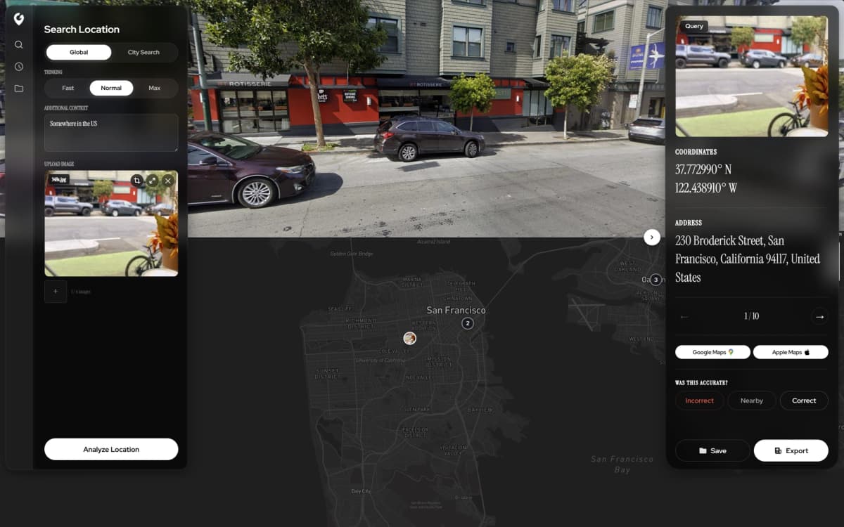
Upload any image and get instant geolocation results — no setup, no expertise. Drag, drop, discover.
Export to PDF
Generate detailed PDF reports with coordinates, confidence scores, and map views — share or archive in one click.
Precise Pinpointing
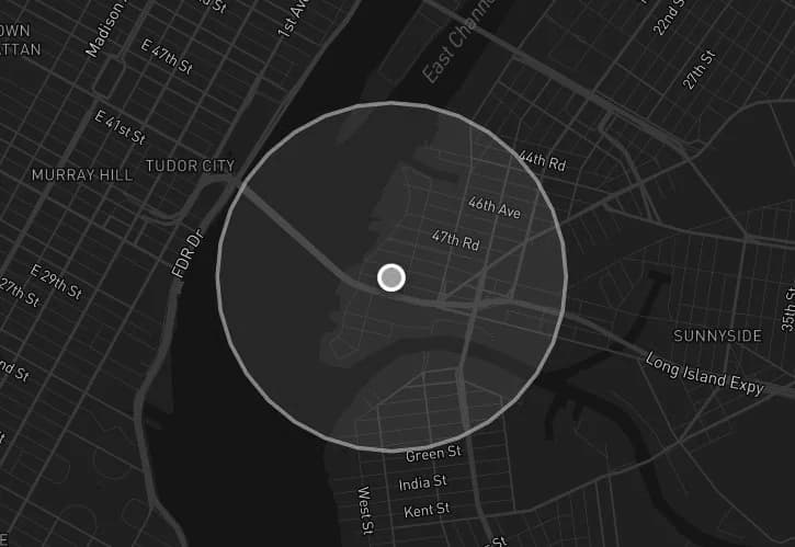
Drop a pin on the predicted location with meter-level accuracy and visualize results on an interactive map.
GeoGuessr Champion
Sharpen your geography skills and dominate GeoGuessr with AI-assisted location intelligence.
Capabilities & Modes.
Explore the AI-powered geolocation tools designed for precision at every scale.


Features FAQ
How does GeoAxis determine a location from an image?
GeoAxis uses advanced AI models trained on millions of geotagged images. Our system analyzes visual cues such as architecture, vegetation, terrain, signage, road markings, and atmospheric conditions to estimate the precise location — no GPS or EXIF metadata required.
What types of images work best with GeoAxis?
GeoAxis works with virtually any image — outdoor landscapes, street views, aerial photos, and even challenging low-light or low-resolution images. The more visual context available in the image, the more accurate the results.
Is my data secure when using GeoAxis?
Absolutely. All uploaded images are processed with enterprise-grade encryption and are never stored permanently on our servers. We follow strict data privacy protocols and comply with GDPR and other international privacy regulations.
Can I integrate GeoAxis into my own application?
Yes. GeoAxis offers a RESTful API that allows developers to integrate our geolocation capabilities directly into their applications, workflows, and platforms. Visit our documentation for API details and usage examples.
What is the difference between Geo-Estimation and Precise Geolocation modes?
Geo-Estimation provides a broad location estimate from low-context images where few visual cues are available. Precise Geolocation uses our full AI pipeline to deliver meter-level accuracy when sufficient visual context is present in the image.
Ready to get started?
Join thousands using AI-powered location intelligence — pick a plan or sign in to your dashboard.
Legal
By using our software, you agree to our Privacy Policy, Terms of Service, Safety Statement, and Refund Policy.
© 2026 GeoAxis | All Rights Reserved