May 14, 2026Guide
How to Use GeoAxis AI
A step-by-step guide to finding the location of any image with the best AI location finder — from upload to coordinates in under a minute.
GT
GeoAxis TeamEngineering

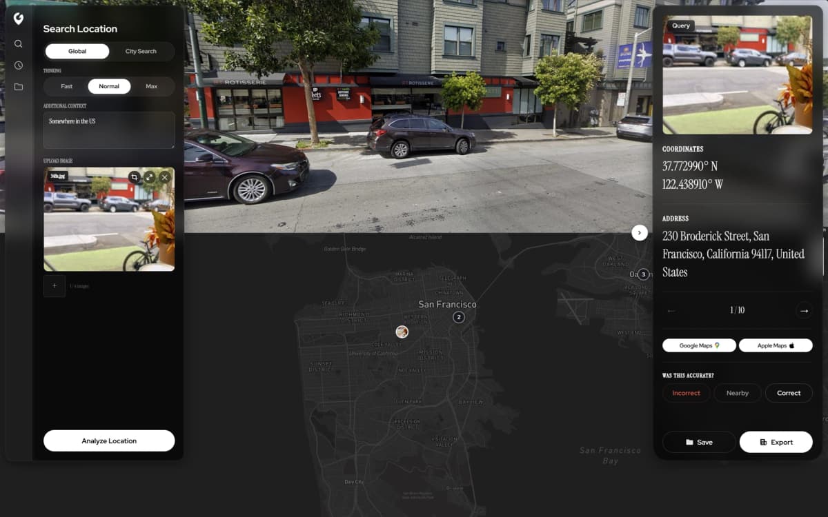
Upload any photo. AI identifies where it was taken in seconds — no GPS, no EXIF, no metadata.

Powerful AI location intelligence at your fingertips — accurate, global, and built with security at every layer.
Advanced AI algorithms analyze images to pinpoint exact locations with unprecedented accuracy.
Access to worldwide location data covering every corner of the planet.
Your data is protected with enterprise-grade security and privacy measures.
Explore the AI-powered geolocation tools designed for precision at every scale.


A step-by-step guide to finding the location of any image with the best AI location finder — from upload to coordinates in under a minute.

Benchmarks, accuracy gains, and why GeoAxis is currently the best AI location finder on the market.

Finding the location of an image is easy with GeoAxis. Learn how AI geolocation works in seconds.
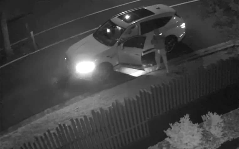
GeoAxis provides meter-level accuracy using advanced AI algorithms. Our technology works even with challenging images including low-light, low-resolution, and partial views.
No. GeoAxis uses AI-powered visual analysis to determine the location of any image — no GPS metadata or EXIF data required. Our AI analyzes landmarks, terrain, vegetation, architecture, and other visual cues to pinpoint where a photo was taken.
GeoAxis delivers results in seconds. Simply upload any image and our AI instantly analyzes it to identify the precise location — no manual work or technical expertise needed.
HyperVision™ is our enterprise solution offering custom city deployments, enhanced accuracy, and priority support for mission-critical applications.
Join thousands using AI-powered location intelligence — pick a plan or sign in to your dashboard.
By using our software, you agree to our Privacy Policy, Terms of Service, Safety Statement, and Refund Policy.
© 2026 GeoAxis | All Rights Reserved